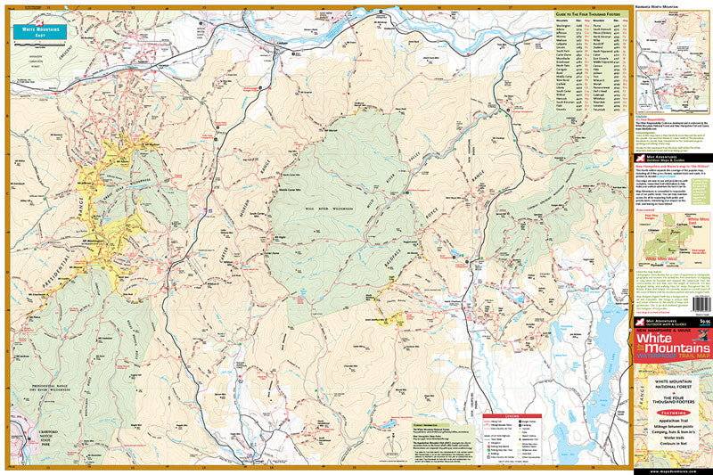
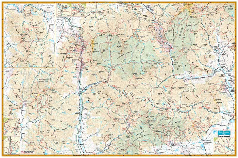
White Mountains
Waterproof Hiking Trail Map
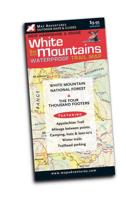


The best keeps getting better – check out what’s new in the 6th edition.
Our most popular map is your favorite too. By popular demand this fifth edition expands the coverage to include all of the 4,000 footers, updated trails and roads. It’s printed on a larger sheet of durable waterproof paper—we were able to keep the same great price, making this an exceptional value.
"The idea of putting the length of trails right on the map is wonderful! I plan hikes simply by looking at the map and being able to determine the length of hikes without having to get out the guide book...thanks so much for the superb effort."
- Gary Tardiff, customer
"The map is first class..." - Conway Daily Sun
Map Features
- White Mountains National Forest
- The Four Thousand Footers
- Appalachian Trail
- Mileage between points
- Camping, huts, and lean-to's
- Parking
- Winter Trails
- Kezar Lake, Maine
Areas Covered
- Mount Washington
- Pinkham Notch
- Carter-Moriah Range
- Franconia Notch
- Twin Range
- Zealand Valley
- Crawford Notch
- Pilot & Pliny Ranges
- Kancamagus Highway
Topographic Map: Waterproof | 36" x 24" unfolded | ISBN 1890060-23-2 | scale 1:75 000 and 1:50 000 | Map Adventures LLC
Digital Version Available
Our digital map versions are the perfect companion maps to our content rich, maps & guides. Download the map on your devices to easily track your location on the map.
Click on the link to buy a digital version of this map for your IOS or Android device.